


5 PM Update: Neither System is a Tropical Storm Yet
- My Personal Weatherman™

- Aug 20, 2020
- 3 min read
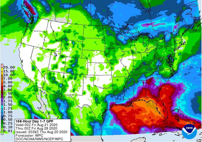
- Each system is struggling to organize for now, but TD13 is still expected to be a hurricane when it nears southern Florida. TD14 is expected to be a tropical storm when it gets near the TX or LA coast. - The 3rd image is the new Euro ensembles. - Check out the last image, which shows the projected rainfall for the United States for the next 7 days from the Weather Prediction Center.
Here are some excerpts from the forecast discussion for each from the NHC, starting with TD13 (the one expected to approach southern Florida):
Recent late afternoon visible satellite imagery has shown evidence of a low-level swirl that is racing away from the persistent area of deep convection. It is unclear if that is the only center of circulation or a swirl rotating around the broader circulation... It should be noted that since the system is still lacking in organization, there could be some center reformations that result in some shifts in the track forecast... Although the depression has changed little in strength since it formed yesterday, the overall environment ahead of the system favors gradual strengthening. The cyclone is forecast to remain over warm water and in an area of light to moderate vertical wind shear. Most of the guidance suggests a little more favorable upper-level wind pattern once the system is north of the Greater Antilles, but a track farther south would result in more land interaction, which increases the intensity forecast uncertainty. FORECAST POSITIONS AND MAX WINDS
INIT 20/2100Z 16.7N 53.9W 30 KT 35 MPH 12H 21/0600Z 17.5N 57.2W 30 KT 35 MPH 24H 21/1800Z 18.3N 60.5W 35 KT 40 MPH 36H 22/0600Z 19.1N 63.5W 40 KT 45 MPH 48H 22/1800Z 20.0N 66.7W 45 KT 50 MPH 60H 23/0600Z 20.9N 70.4W 50 KT 60 MPH 72H 23/1800Z 22.2N 74.1W 60 KT 70 MPH 96H 24/1800Z 25.1N 80.4W 65 KT 75 MPH 120H 25/1800Z 28.3N 84.2W 65 KT 75 MPH
Now for TD14: An Air Force Reserve Hurricane Hunter aircraft investigating the system found an area of lighter winds--likely where the center would be--farther south than previous estimates... The depression's farther-south position makes the intensity forecast more complicated with potentially more land interaction with parts of Central America. Slight strengthening to tropical storm strength is expected before the center reaches Honduras and Nicaragua, with little change thereafter until the center re-emerges over the Gulf of Honduras. Low shear and warm sea surface temperatures should then support further intensification up until it reaches the Yucatan Peninsula. Since there is significant uncertainty in how land interaction will affect the cyclone's intensity, the forecast intensity has been flat-lined between day 2 and day 4, with the understanding that the the winds could increase or decrease from the value shown. Vertical shear is expected to increase by day 5, and some weakening is shown at that time.
FORECAST POSITIONS AND MAX WINDS
INIT 20/2100Z 14.3N 81.0W 30 KT 35 MPH 12H 21/0600Z 14.7N 83.0W 35 KT 40 MPH 24H 21/1800Z 15.6N 84.7W 35 KT 40 MPH...INLAND 36H 22/0600Z 17.0N 85.6W 45 KT 50 MPH...OVER WATER 48H 22/1800Z 18.7N 86.6W 55 KT 65 MPH 60H 23/0600Z 20.3N 87.9W 55 KT 65 MPH...INLAND 72H 23/1800Z 22.1N 89.2W 55 KT 65 MPH...OVER WATER 96H 24/1800Z 26.0N 91.5W 55 KT 65 MPH 120H 25/1800Z 28.5N 93.5W 50 KT 60 MPH


Comments