



Quick update and the latest maps for the late-week storm:
- My Personal Weatherman™

- Nov 20, 2022
- 1 min read
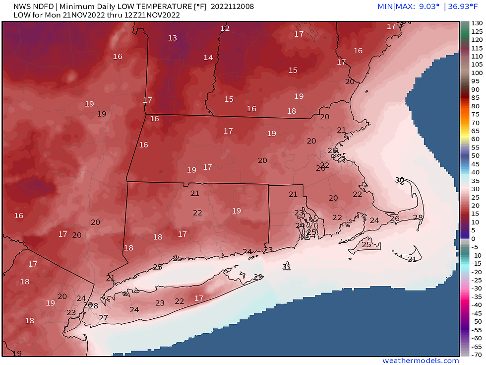
- Today will have a January feel with highs only in the upper 30's on Long Island with wind gusts up to 35 mph, and then a very cold night ahead (see 2nd image for overnight lows) with breezy conditions still.
- While the exact details are uncertain, we still have the rain and wind for Friday into early Saturday. I have posted the Model Blend rain and precipitation maps below. You can see the projected storm location/intensity from the Euro ensemble members in the 1st image.



Comments