


Update on Epsilon, snow, and the Long Island forecast:
- My Personal Weatherman™

- Oct 20, 2020
- 2 min read
Tropical Storm Epsilon is still forecast become a hurricane, but there is a little more confidence now that it will stay east of Bermuda, but it will still come fairly close. Currently, maximum sustained winds are 45 mph with a minimum central pressure of 998 mb. From the National Hurricane Center: "Epsilon is forecast to be at or near hurricane strength when it approaches Bermuda late this week. While it is too soon to determine the exact details of Epsilon's track and intensity near the island, there is a risk of direct impacts from wind, rainfall, and storm surge on Bermuda, and interests there should closely monitor the progress of Epsilon."
The system in the western Caribbean still only has a 10% chance of tropical development, according to the National Hurricane Center. From the NHC: "This system is currently accompanied by disorganized shower and thunderstorm activity. The disturbance is expected to consolidate over the northwestern Caribbean Sea during the next day or so before moving slowly westward toward the Yucatan peninsula by Wednesday. Regardless of development, the system could bring locally heavy rainfall to portions of central and western Cuba, Jamaica, the Cayman Islands, and the Yucatan peninsula through midweek."
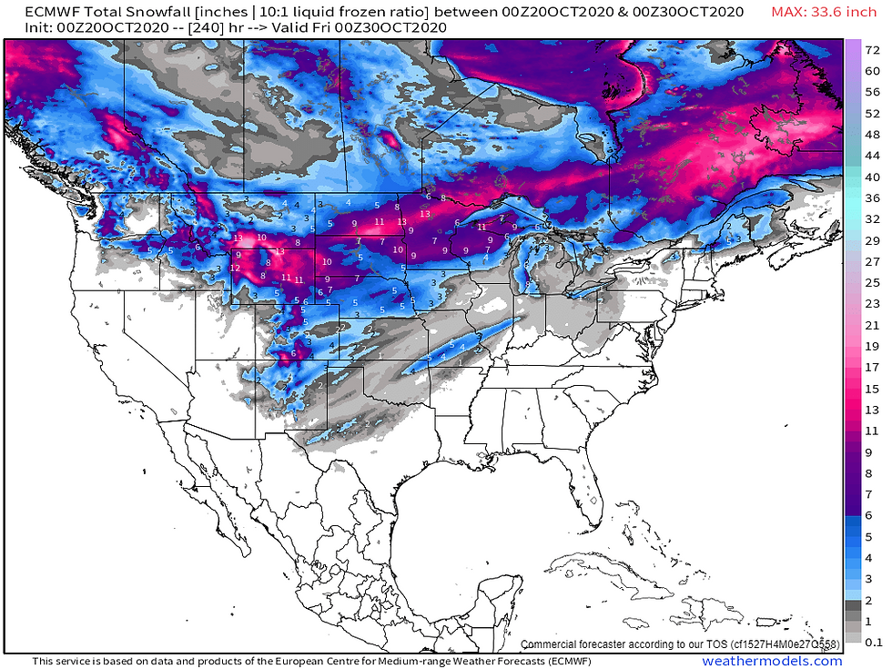
The 3rd image shows the projected snowfall for the next 10 days from the Euro, and it shows pretty impressive coverage for October.
Overall, the mild weather continues for Long Island and the northeast, but it will be much cooler on Sunday. It will then warm up again ahead of the next strong cold front for the middle of next week, which may bring gusty winds with it, and then it will be much cooler behind the front.
Long Island forecast:
Today: 70% chance of rain this morning, especially the south shore and eastern Suffolk early this morning. There is an area of moderate to heavy rain just south of Long Island as of 4:30 AM that is moving northeast. After this moves through, it will be cloudy with some drizzle and a chance of a shower with an onshore flow. Highs mostly around 70 degrees.
Tomorrow: Some patchy fog, drizzle, and light rain in the morning with some breaks of sun possible in the afternoon. Highs in the low 70's.
Thursday: Partly to mostly sunny with highs in the low 70's.
Friday: Partly cloudy with highs in the mid to upper 60's.
Saturday: Partly to mostly cloudy with highs in the mid to upper 60's.
Sunday: Partly cloudy and much cooler with highs around 60 degrees.
- 1st image: Tropical Storm Epsilon
- 2nd image: Euro ensembles for the next 15 days
- 3rd image: Projected snowfall for the next 10 days from the Euro
- 4th image: Projected precipitation for the next 7 days from the Weather Prediction Center
- 5th image: Projected temperatures for Long Island for the next 10 days from the National Weather Service model blend


Comments